Manoa Cliff Trail is a fantastic Honolulu hike, and when you continue onto Pauoa Flats, you’re rewarded with stunning views (and a good workout!) But learn from our recent mistakes at this Hawaii hiking trail, and make sure you time your adventure right!
Manoa Cliff Trail Quick Facts
Difficulty Level: Moderate
Distance: 4 miles round trip, out-and-back (6.2 miles round trip if you venture onto Pauoa Flats Trail)
Location: Round Top Drive, Honolulu
Cost: Free
Learn From Our Hawaii Hiking Mistake
Nightfall chased us out of Mt. Tantalus the other day. Thank goodness for cell phone flashlights, or else we would’ve really been in the dark.
My younger sister and I spontaneously decided to do one of our favorite hikes at the top of Round Top Drive – it starts with the Manoa Cliff Trail (2.3 miles) before connecting with Pauoa Flats Trail (0.75 miles). The grand finale is the Koolau summit, then you turn around and hike back.
This time, however, it ended in a slightly different way – in the pitch black of night, with only a foot of visibility ahead!
A Late Start and Poor Timing
Let this be a lesson of what NOT to do on a hike in Hawaii.
Rule #1: Make sure you have enough time in the day to make it back safely.
I admit that I got so into filming and taking pictures that I lost track of time. We started at 4:30 p.m.and usually the hike takes about two to three hours total. By the time we reached the end – a breezy lookout above the Nuuanu fishing reservoir – we looked at the time, “Oh no! It’s already 6:15!”
That’s when I snatched my dog (who was in mid-sniff), and we booked it back, powering through the uphill and splashing through the muddy parts, not caring about dirtying our shoes. I could tell the sun was already set by the grayness in between the trees that bordered Manoa Valley.
We had about an hour’s worth of hike left and probably only 40 minutes of light.
Rushing Back
Feral pigs, weirdos, potential injuries – just a few fears that raced through my mind and made it seem like my legs couldn’t move fast enough. A rustling in the shadowed foliage sent us in a full sprint. With the cell phone flashlight seemingly dimmer by the minute, I reassured my sister that we were almost there, almost there!
Seeing the iron grate path at my feet gave me that reassurance I needed to support my fading optimism. We were nearing the Manoa Cliff Trail trailhead. By this point, with 10 minutes left, we found ourselves relying on the faint outline of the marked path for guidance. Still, only almost there. But nothing looked familiar anymore, with the black around us slowly starting to creep in on our only source of light.
A Safe Return (and a Lesson Learned)
The gray, moon-lit road through the thick guava trees ahead let us know that we finally made it! The time: 7:15 p.m. The mood? Muddy, exhausted, and relieved!
We did, however, manage to locate the last bit of humor in our depleted spirits, joking that it’s ALWAYS an adventure with Alyssa, Ariel, and Pakala (my dog). You don’t even want to know why…ha!
What to Expect at Manoa Cliff Trail & Pauoa Flats
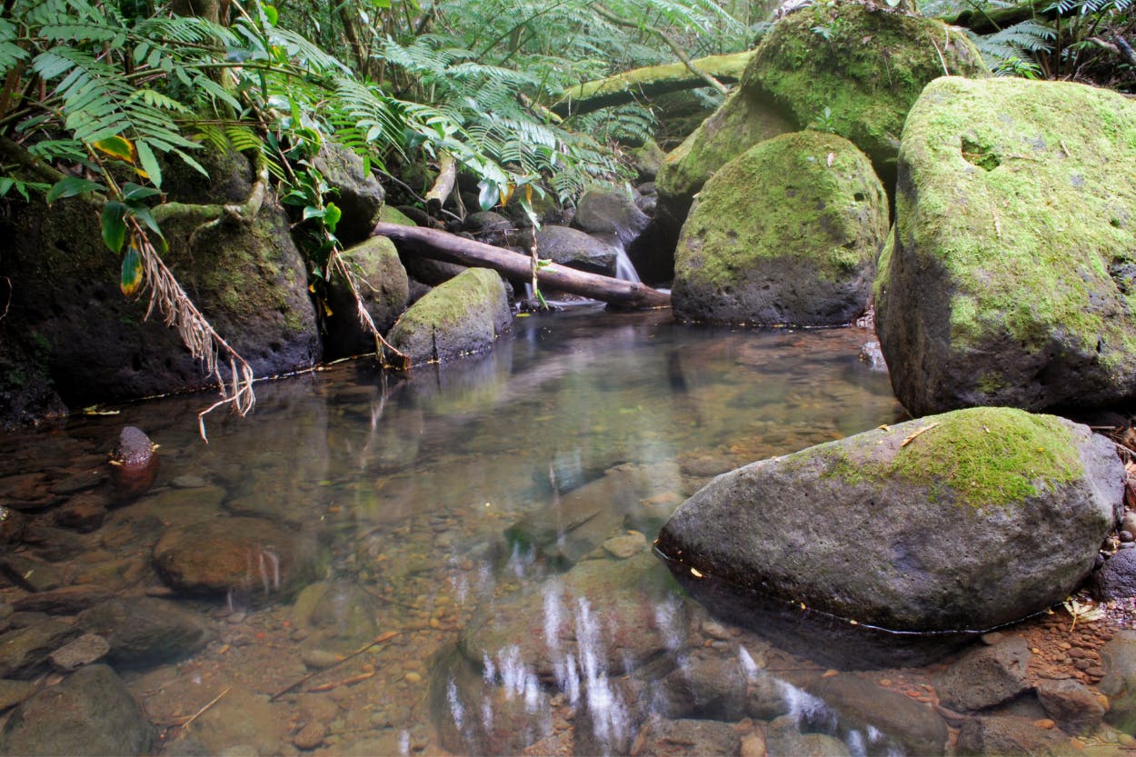
Overall, this is a beautiful hike through a lush, native forest so isolated from the city that bird chatter and whistling winds become the norm.
You’ll notice the different groves of trees as you hike along the cliffs above Manoa and around Tantalus Crater. Huge guava trees and koa engulf the trailhead before you wander down into a booming forest of bamboo so vast it extends beyond one’s visual scope.
We’ve hiked the Manoa Cliff Trail so many times that the trees have become natural landmarks. Once we pass through the second bamboo grove, we know it’s about five minutes to the lookout.
Because it’s about 500 feet in elevation, the trail gets more rain than other parts of the valley. So hikers should expect mud. Volunteers who maintain Monoa Cliff Trail have laid out cut logs and branches through the muddiest parts. This helps, but I still wouldn’t suggest wearing brand-new kicks here.
The plus side to being so high up? The spectacular views of Manoa and Nuuanu valleys – the tiny cars and houses below confirm the height.

How to Get to Manoa Cliff Trail
Drive up Round Top, past Puu Ualakaa State Park. Then continue up the winding road until you see the brown and yellow Manoa Cliff trailhead sign to your right (about a 10-minute drive). This hike has a small, shaded parking area to the left.
The Manoa Cliff Trail intersects three other trails. The first intersection will be the Puu Ohia Trail on the left, and the second is the Pauoa Flats Trail on the right. You can also take the Kalawahine Trail, which will loop back 1.1 miles to Tantalus Drive.
Our Hawaii Hiking Recommendation
Manoa Cliff Trail is one of our favorite Honolulu hikes. A forested path, a scenic overlook, and a little mud and dirt to feel really at-one with nature. Which Oahu hike is your favorite? Let us know, and contact Hawaii Aloha Travel for help planning a Hawaii vacation full of fun hikes (or a little hiking and a lot of R&R!)


