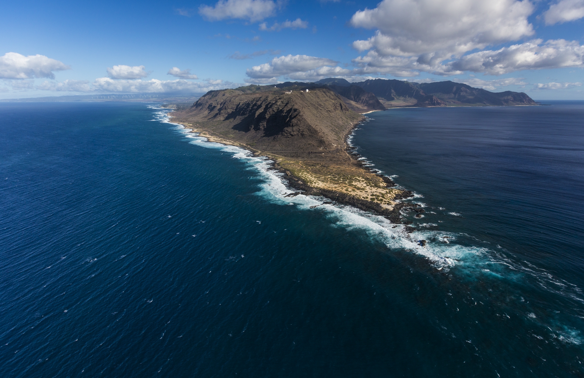
One small corner of Oahu is only accessible on foot: Kaena Point. Roads from both directions end at this westernmost edge of the island, making it impossible to drive completely around Oahu. This seclusion preserves one of the last intact dune ecosystems in the main Hawaiian islands.
A Sacred Place for Hawaiians, a Sanctuary for Wildlife
From ancient times, Kaena Point was known as the “leaping place of souls,” where the spirits of the recently dead could reunite with their ancestors. It is now home to endangered seabirds and is a nesting site for sea turtles and the Hawaiian monk seal. During the winter breeding season, humpback whales also frequent the area.
Just as we moved from the water onto a beach covered with coral, a monk seal swam up to rest. It seemed willing to ignore us if we kept our distance (we did because it’s the law, but also because it was so large and imposing).
But how do you see this remote part of Oahu?
Kaena Point Hike
To reach Kaena Point, you’ll hike about two and a half miles from either Waianae on the Leeward coast (the southern access called Keawa’ula), or past the North Shore (northern access called Mokuleia).
Southern Access to Kaena Point (Keawa’ula)
We went from Yokohama Beach, just past Waianae, at the end of Farrington Highway. The pavement gave way to a trail, and at one point, the planks placed over an open space along the cliff had broken, so we had to climb along a rock path.
This isn’t the best family hike on Oahu, though we did pass by a Boy Scout troop the day of our trek. The hike is generally considered moderate-difficult, and it was certainly a challenge for us.
For a flat-lander like me, it was disconcerting to look down the cliff to the rocky shore far below. It may be less challenging to enter from the other side.
Northern Access (Mokuleia)
Most families will opt to access Kaena Point from the northern access, called the Mokuleia side. This is more of a dirt path that extends 2.5 miles from the end of North Shore’s stretch of Farrington Highway. It’s typically ranked as an easy-moderate hike, though the intense heat and sun can make it a challenge.
We Blog About Hawaii Because We Love Hawaii
What to do at Kaena Point
Once inside Kaena Point State Park, you’ll likely see some kind of wildlife. This is a bird sanctuary and a great place for seeing humpback whales in the winter months. Many visitors spot spinner dolphins, nesting seabirds, and monk seals.
The remnants of an old lighthouse mark Kaena Point, where most visitors stop, take in the sights, and then turn around to hike back.
This isn’t a great place for swimming, as the water is rough and there aren’t any lifeguards. This hike is more about the journey, taking in the sights along the way, and exploring a remote area of Oahu’s treasured landscape.
Tips for Hiking
The Hawaii Department of Land and Natural Resources warns that the Kaena Point trail is usually hot and sunny, cautioning that hikers should take ample water and wear cool clothing, a hat, and sunscreen. I would add that restrooms are not always reliable, so it is a good idea to expect no facilities. Pack your trash back out, and do not bring dogs – they disturb the bird nesting areas.
If you walk gently, you will be rewarded with one of the rarest experiences on earth.


